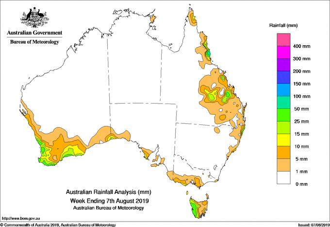
Past seven days: In the first part of the week, a moist onshore flow produced light to moderate falls along the central to northeast coast of New South Wales and southeastern Queensland. A surface trough located through inland Queensland triggered thunderstorm activity, with moderate falls recorded in parts of the Central Highlands and central coast of the State.
A weak cold front tracked across Tasmania during the middle of the week, producing light falls in southern Victoria and moderate falls in western Tasmania.
At the end of the week, a strong cold front approached and tracked across southwest Western Australia. Moderate falls were recorded in the southwest of Western Australia before the cold front moved across the Bight. A moist onshore southeasterly flow brought showers and moderate falls to the north tropical coast of Queensland at the end of the week.
Rainfall totals in excess of 50 mm were recorded about the north tropical coast of Queensland, small parts of the northeast New South Wales coast and an area in western Tasmania. The highest weekly total was 84 mm at Bingil Bay in northern Queensland.
Rainfall totals between 10 mm and 50 mm were recorded in far southwest Western Australia; western Tasmania; along the central to northeast coasts of New South Wales; parts of the north tropical coast, central and southeast Queensland.
Little or no rainfall was recorded in remaining parts of Western Australia, the Northern Territory, most of South Australia, Victoria away from the southern coastline, northeastern Tasmania, New South Wales except about northeast coast, and most of Queensland away from the east coast.
Highest weekly totals
New South Wales and Australian Capital Territory
83 mm Yamba Pilot Station
56 mm Byron Bay (Cape Byron AWS)
52 mm Ballina Airport AWS
Victoria
11 mm Cape Nelson Lighthouse
10 mm Ferny Creek, Wonthaggi, Warrnambool Airport
Queensland
84 mm Bingil Bay
78 mm South Johnstone Exp Stn
68 mm Innisfail Aerodrome
Western Australia
45 mm Lancelin, Cape Leeuwin
42 mm Serpentine
South Australia
10 mm Parawa (Second Valley Forest)
6 mm Parndana (Turkey Lane)
5 mm Multiple locations
Tasmania
64 mm Mount Read
35 mm Lake Margaret Power Station
31 mm Queenstown (South Queenstown)
Northern Territory
3 mm Gove Airport
0.2 mm Ngayawili, Centre Island
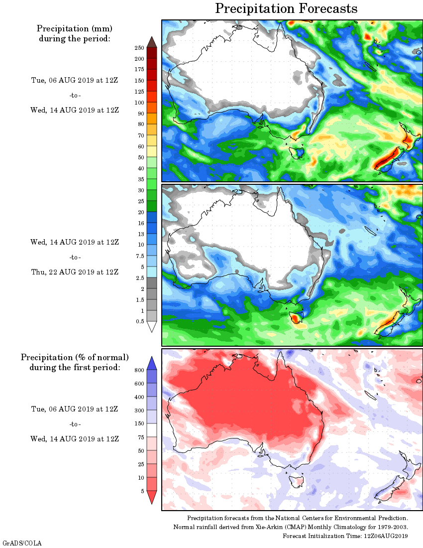
Rainfall outlook:


HAVE YOUR SAY