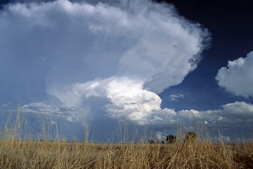
THE Bureau of Meteorology (BoM) recently declared that La Nina is official for the back end of 2020, with indicators now below threshold levels.
You would be right to be cautious in equating this to a wet finish to the year though, as currently this is not a particularly strong La Nina, starting much later than the 2011-2012 event which resulted in significant flood-causing rains around the country.
To really understand what’s going on behind the scenes here it helps to understand more about the evolution of Australia’s seasonal climate forecasting system, how these phenomena were identified and how they are used now to forecast the climate.
Please excuse the acronyms, but in the world of forecasting it’s nearly impossible to communicate without them!
Whilst the BoM was established in 1908, the first seasonal climate forecast (SCF) wasn’t produced by BoM for another 80 years.
The path to the first SCF was long, and an in depth understanding of the global climate system did not really crystalise until 1960 with the identification of the El Nino- Southern Oscillation (ENSO).
The discovery of El Nino
El Nino has been written about since the 16th century, Spanish colonists in South America experiencing the effect of warm waters flowing to Peru having major impacts on the oceans off the coast as well as onshore rainfall over what was usually desert.
Peruvian scientists again noted its effects in the 19th century but were unable to explain its extent or cause.
The explanation of this phenomenon, now called ENSO, can be largely attributed to two people:
- Gilbert Walker, an English physicist who identified and christened the southern oscillation phenomenon in the 1920s, and
- Jacob Bjerknes who explained how this impacted global weather, coining the “Walker Circulation” in 1969.
Simply put: Walker had identified see-sawing atmospheric pressure patterns between the Indian and Pacific oceans – the “SO” half, now measured by the Southern Oscillation Index (SOI) – a numerical representation of differences in atmospheric pressure in the Pacific Ocean.
Bjerknes then tied the atmospheric pressure phenomenon to the sea surface temperatures (SSTs), essentially establishing the link between the “SO” and El-Nino.
Using ENSO to forecast
The first SCFs produced in Australia in 1989 were based on the statistical relationship between the SOI and Australian rainfall.
Nearly a decade later in 1998 the predominant source of predictability for ENSO switched from Pacific Ocean atmospheric pressure to sea surface temperatures.
Around the same time, the Indian Ocean was attracting attention from a Japanese researcher Professor Toshio Yamagata.
Initially dismissed as a “slave to ENSO”, by 1999 the Indian Ocean had become established as an independent driver of Australian weather patterns and the phenomenon is now referred to as the Indian Ocean Dipole (IOD).
From 1998 to 2012 the sea surface temperatures from these two oceans were used to produce a forecast based on previous correlations between the Indian and Pacific Ocean SSTs and Australian rainfall.
This statistical methodology for forecasting was viewed as limited due to its assumption that the future is based on the past, that the cycle or pattern will repeat itself, which is not always the case.
A new way of forecasting
Around the turn of the century weather forecasting worldwide underwent a shift to a different form of forecast, made possible by continuing improvements in computing power.
The shift was from statistical forecast models to dynamical forecast models: essentially these were a digital representation of the earth and atmosphere that use algorithms defined by the laws of physics to produce a forecast.
The CSIRO and BoM developed Australia’s first dynamical model in 2002 called Predictive Ocean Atmosphere Model for Australia (POAMA).
This model is described as a coupled ocean and atmospheric (physics based) climate model that uses ocean, atmosphere, and land observations to initiate outlooks up to nine months ahead.
However, it wasn’t until 2013 that BoM had tuned the system adequately and transitioned to POAMA for its seasonal climate outlooks.
POAMA to ACCESS
In 2018 a new model was brought online called the Australian Community Climate and Earth-System Simulator Seasonal prediction system version 1 or ACCESS S1, someone tried hard to make that acronym fit.
BoM decided not to attempt to build this one in-house as it had with POAMA and purchased ACCESS from the UK Met Office.
Simply put: ACCESS has a higher resolution for the land, atmospheric and ocean models, as well as significantly updated model physics.
The previous horizontal resolution of POAMA was such that Tasmania and the Great Dividing Range were invisible, so they were basically useless at predicting east coast lows, an issue fixed by the higher resolution of ACCESS.
From 1989 to 2020 Australia has moved from a statistical model to POAMA to ACCESS S1, newer versions of ACCESS (S2 and S3) are pegged to come online over the coming years with various tweaks.
Only 30 years have passed since the first SCFs were produced, an incredibly short period of time when you consider the increases in skill that have occurred.
Most of these skill increases occurring in the last seven years. The model’s ability to simulate air, land and ocean processes over the maritime continent to Australia’s north remains a key challenge, along with a better Indian Ocean Dipole representation in the model.
Source: Ag Econ
In northern-inland NSW, Ag Econ has recognised the need for timely and independent climate analysis tailored to farmers and advisors, in an increasingly challenging environment to operate agricultural businesses. Go to https://www.agecon.com.au/subscribe or follow on social media @AgEconAus
Further information:
Why’s It Called El Nino, and How Did Scientists Figure Out What It Is? (Julia Busiek 2015)
Predictability of the Super IOD Event in 2019 and Its Link With El Niño Modoki (Yamagata 2020)
ACCESS S1: The new Bureau of Meteorology multi-week to seasonal prediction system (Hudson 2017)

I think Charles Nason’s comment is very pertinent. The bom must have very clear records of their seasonal forecasts to compare with actual rainfall records. I would like to see how they have correlated over time. I seem to recall plenty of times when they were away off the money and we would have been way better off if they had have told us that they really had no idea any further out than a week. The eternal optimist in me is hopeful they will get better with practice.
This is a long overdue article which tries to simplify climate which unfortunately is very complex
However it does skip over the poor forecasting record of BOM over the last 10 years which suggests we still have a long way to go
In the last decade we have seen the ultimate variation of near record floods and droughts
The near record drought of last year happened with a reasonably neutral SOI which demonstrated the unappreciated significance of the IOD and SAM
The 2014 winter forecast was well out as was this year’s wet winter
Will the same happen to the proposed wet summer?
Those in charge of climate work need to appreciate that farmers ( and thus the wider community ) depend heavily on good forecasts and if BOM does not know , maybe they need to admit so
The flow on effects to the economy are very significant and good and accurate forecasting has a high level of public good with a high return to public funding
Has BOM been carried away with “climate change” and forgotten their core charter of predicting weather and climate
A quick read of climate over the last 1000 years suggests we have not seen the full variation in climatic variability and our instrumental record displays a fairly benign period
How would we cope with the natural variation the human race has endured over the last 20 k years since the depth of the last ice age
I suspect not well!